The development of Helene in the northwestern Caribbean is more than just another weather update. For millions of residents across the Gulf Coast and the southeastern United States, it signals the start of a tense period filled with preparation, uncertainty, and constant attention to forecast updates.
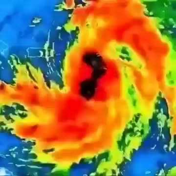
Meteorologists have been tracking the system closely as its circulation becomes increasingly organized and clusters of thunderstorms strengthen around a developing center. While many tropical systems begin as broad, disorganized disturbances, forecasters say conditions appear favorable for Helene to continue developing as it moves northward.
At this point, the primary concern is not whether the system will become a tropical storm—it is how rapidly it could intensify once it reaches the warm waters of the Gulf of Mexico.
Sea surface temperatures across much of the Gulf remain exceptionally warm, providing the fuel tropical cyclones need to grow stronger. Combined with relatively favorable atmospheric conditions, those waters could allow Helene to strengthen significantly in a short amount of time.
A sprawling area of thunderstorms can sometimes evolve into a dangerous hurricane within just a few days.
That possibility has emergency officials watching the system carefully.
Current forecast models suggest Helene could move toward portions of Florida’s Gulf Coast, including areas near the Florida Panhandle and sections of West Central Florida. Some projections indicate the storm could reach hurricane strength before landfall, bringing impacts that extend far beyond coastal communities.
However, forecasters continue to emphasize a critical point: hurricane forecasts are not guarantees.
Even a relatively small shift in the storm’s track can dramatically change where the strongest winds, heaviest rainfall, and most dangerous storm surge occur. What appears to be a minor adjustment on a weather map can mean vastly different outcomes for individual communities.
That uncertainty is exactly why preparation matters.
Residents throughout Florida, Georgia, South Carolina, and neighboring states are being encouraged to monitor official forecasts closely and review emergency plans well before conditions begin to deteriorate.
While wind often receives the most attention, it is not always the deadliest aspect of a hurricane.
Storm surge remains one of the greatest threats during major tropical cyclones. As powerful winds push ocean water inland, familiar coastlines can quickly become unrecognizable. Roads may disappear beneath rising water. Homes near bays, rivers, and coastal areas can become isolated. In severe situations, entire neighborhoods can be inundated.
For areas vulnerable to storm surge, evacuation orders are often issued long before the storm arrives.
Waiting until conditions worsen can leave residents with few safe options as roads become flooded and travel grows increasingly dangerous.
Heavy rainfall presents another serious concern.
Tropical systems frequently generate bands of intense rain that stretch hundreds of miles from the storm’s center. These rain bands can trigger flash flooding, overwhelm drainage systems, and transform small creeks into rapidly moving waterways.
In some cases, inland communities experience the worst flooding, despite never encountering hurricane-force winds.
Helene’s potential impact highlights how tropical systems rarely affect just one location.
A storm approaching Florida can create flooding concerns in Georgia.
A Gulf Coast landfall can produce damaging winds deep into the Southeast.
Tornadoes may develop within outer rain bands hundreds of miles away from where the center comes ashore.
The storm’s reach often extends far beyond the forecast track shown on television maps.
Emergency officials continue urging residents to take practical steps before conditions become urgent.
Review emergency supply kits.
Protect important documents.
Refill prescription medications.
Check evacuation routes.
Prepare generators and backup power sources where appropriate.
These simple precautions can make a significant difference if the storm strengthens.
One of the greatest challenges emergency managers face is complacency.
Communities that have experienced repeated near misses sometimes become less responsive to warnings. Others focus solely on the projected center of the storm while overlooking hazards that can occur far outside the forecast cone.
Meteorologists repeatedly stress that every storm is unique.
Helene’s exact track, strength, and impacts remain uncertain, and forecasts will continue evolving as new data becomes available.
For now, the focus remains on readiness.
The coming days will determine whether Helene becomes a relatively modest tropical system or a powerful hurricane. They will reveal which areas face the greatest risks and what protective actions may become necessary.
Until then, residents across the region are entering a familiar but uneasy waiting period.
Watching forecast updates.
Checking emergency supplies.
Calling family members.
Reviewing evacuation plans.
And hoping the storm ultimately proves less severe than feared.
Because while hurricane forecasting has improved tremendously over the years, one truth remains unchanged: the best time to prepare is before warnings are issued, before evacuation orders are announced, and before the first bands of rain begin moving ashore.
For now, Helene remains a developing system.
But for communities across the Gulf Coast and southeastern United States, the countdown has already begun.